Share this page

Facebook Twitter LinkedIn Email

Penmachno Mountain Bike Trails

39 reviews

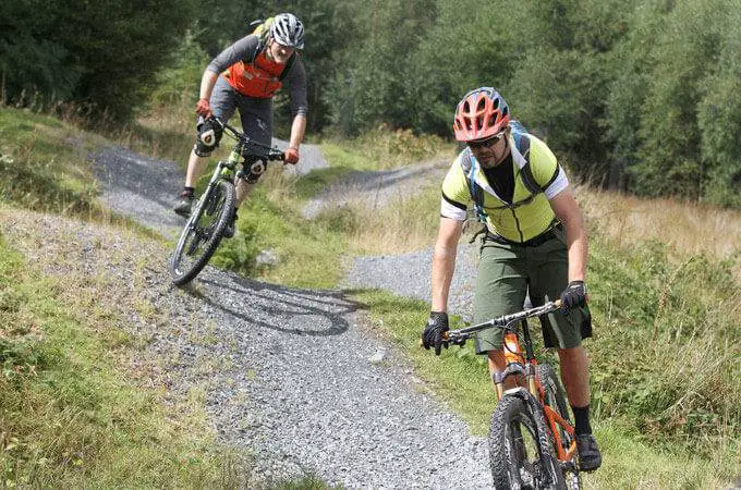
The Penmachno Mountain Bike Trail, south of Betws-y-Coed in North Wales is challenging trail with some steady climbs taking in some more spectacular scenery. Read more


place Betws-y-Coed, LL24 0YP

link www.penmachnobiketrails.org.uk


Open - All Clear

View all

Videos

Trail Reviews Summary

Fun factor
Fun factor 8.5128 out of 10
Trail variety
Trail variety 8.3333 out of 10
Trail quality
Trail quality 8.4615 out of 10
Facilities
Facilities 7.9231 out of 10
Location
Location 8.5128 out of 10

"A tad icy in sections"
Review by: martin_fry on 4 February 2011


Read all reviews

Description

The Penmachno Trails have the perfect mix of singletrack descents & forest climbs (with a few technical climbs thrown in for good measure!). They can be ridden as one 30km route or as a 19km loop (Loop 1), or a 11km loop (Loop 2). Loop 2 branches off from Loop 1 at around the halfway point so, if you're not certain which one to ride start on Loop 1 and see how you feel when you get to the Loop 2 junction!

Dolen Machno (Loop 1) - 19km
This has the fastest descents and biggest climbs, with fast, technical single-track, tight switch-backs and a couple of leg-testing climbs. The fun just never stops!

Dolen Eryri (Loop 2) - 11km
This is all about the flow and the views, with a great mix of sweeping single-track, carving boardwalk, technical pitched stone trail and some of the best views you'll find in the UK. A truly breath-taking ride.

Penmachno Trail (combined Loop 1 & Loop 2) - 30km
This has got it all - 30km of fast descents, flowing singletrack, technical riding & boardwalk plus views across the Snowdonia mountains.

Facilities

  • Parking Parking

Location

Nearest Town: Betws-y-Coed
Website: www.penmachnobiketrails.org.uk
Sat Nav: LL24 0YP
Grid Ref: SH 786498

Want to view the location of this trail?
Login or Sign-up by clicking the button below.

Register Sign In

Nearby Trails

Please note: Distance is calculated as air distance or "as the crow flies" the most direct route between two points, so the distance by road maybe slightly longer.

Nearby Accommodation

Submitted by:
Last modified: 2020-08-05 08:50:47

Disclaimer: All trails and location details have been submitted to this website by independent contributors and resources. We hold no personal responsibility for the accuracy or legality of any trail description or location published herein. All listings are for information only.